
Text: Andreas Edholm, Senior Tourism Developer
Quality criteria based on the National Framework
The hiking trails in this article meet basic quality criteria in the National Framework for Hiking Trails and are on land where the state is not the principal. These hiking trails are a first selection of the hiking trails in the county’s eight municipalities, five destinations and five pilgrimage trails.
östersund municipality: Bynäset runt
- Length: 7 km round trip
- Elevation gain: 49 m
- Start: Big parking place
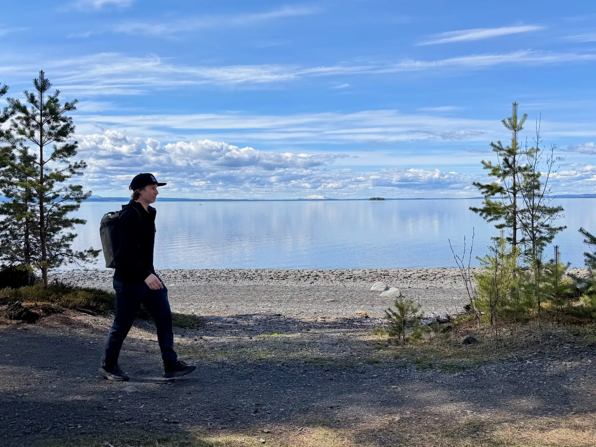
At beautiful Bynäset on Frösön you can walk around a distance of about 7 km, run, cycle and swim. Feel free to bring a backpack and walk around the scenic spot. When you feel warm, you can walk to the beach and take a swim. The trail mostly runs close to the water with very beautiful views of the lake and the mountains. The southern end of the trail is accessible with a gravel path about 2 km long that leads to a rest area with benches and tables by the beach. The northern part begins with about 600 meters of gravel road that leads to Bynäset’s wind shelter (sleeping) with benches and a view of Storsjön and the mountains. The rest of the trail is a forest path where there are a lot of roots in some parts.
There are three different tours on Bynäset: Bynäset runt (green) is 7 km and winds through a varied forest environment along the shores of Storsjön. The trail mostly runs close to the water with very beautiful views of the lake and the mountains.
The Bynäset shortcut (yellow), turns off from Bynäset around and goes along a fence over the islet. The trail is about 2.4 km long and goes on a gravel road, along a path and on a footbridge.
Easy hiking trail (red). The southern end of the Bynäset trail is accessible with an approximately 2 kilometer long gravel path that leads to a rest area with benches and tables by the beach.
Ragunda municipality: kullstabergsleden
- Length: 7,6 km roundtrip
- Elevation gain: 240 m
- Start: Kullstabacken parking lot
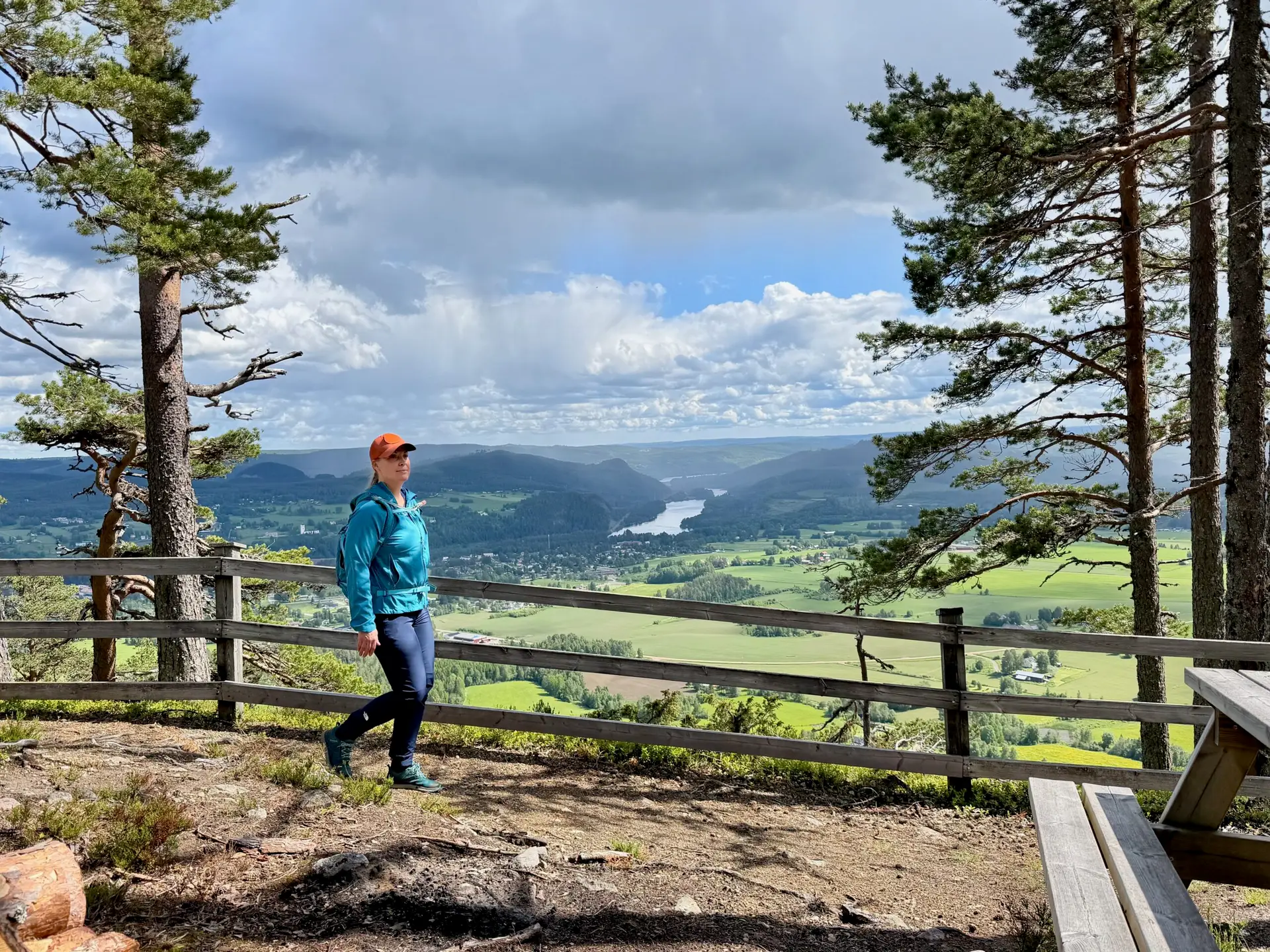
Follow the ridge of Kullstaberget and enjoy beautiful views and don’t miss Hammarstrand’s own “Hollywood sign”!
The trail starts at the foot of the slalom slope (blue marking) and takes you up to Kullstaberget, via the toboggan run, on a nice gravel road. At the top of the mountain, you then follow a path right along the edge of the mountain where you can enjoy the beautiful view down over Hammarstrand and the valley. There is a nice rest cabin on the edge of the mountain about a kilometer from the top, with a fireplace.
The path then winds on towards Europe’s largest place name sign, the Hammarstrand sign! It is 68 meters long and has 8 meter high letters! Maybe you immortalize yourself next to the sign in traditional Hollywood style?! There is also a shelter and fireplace here. The view over the countryside is fantastic! The trail then continues down the mountain. It can be quite steep in some parts. Then the trail goes through the village of Kullsta back towards the slalom slope. Of course, it is possible to walk the trail in both directions.
Bräcke municipality: Forsaleden
- Length: 7 km oneway
- Elevation gain: 140 m
- Start: Northern or southern parking
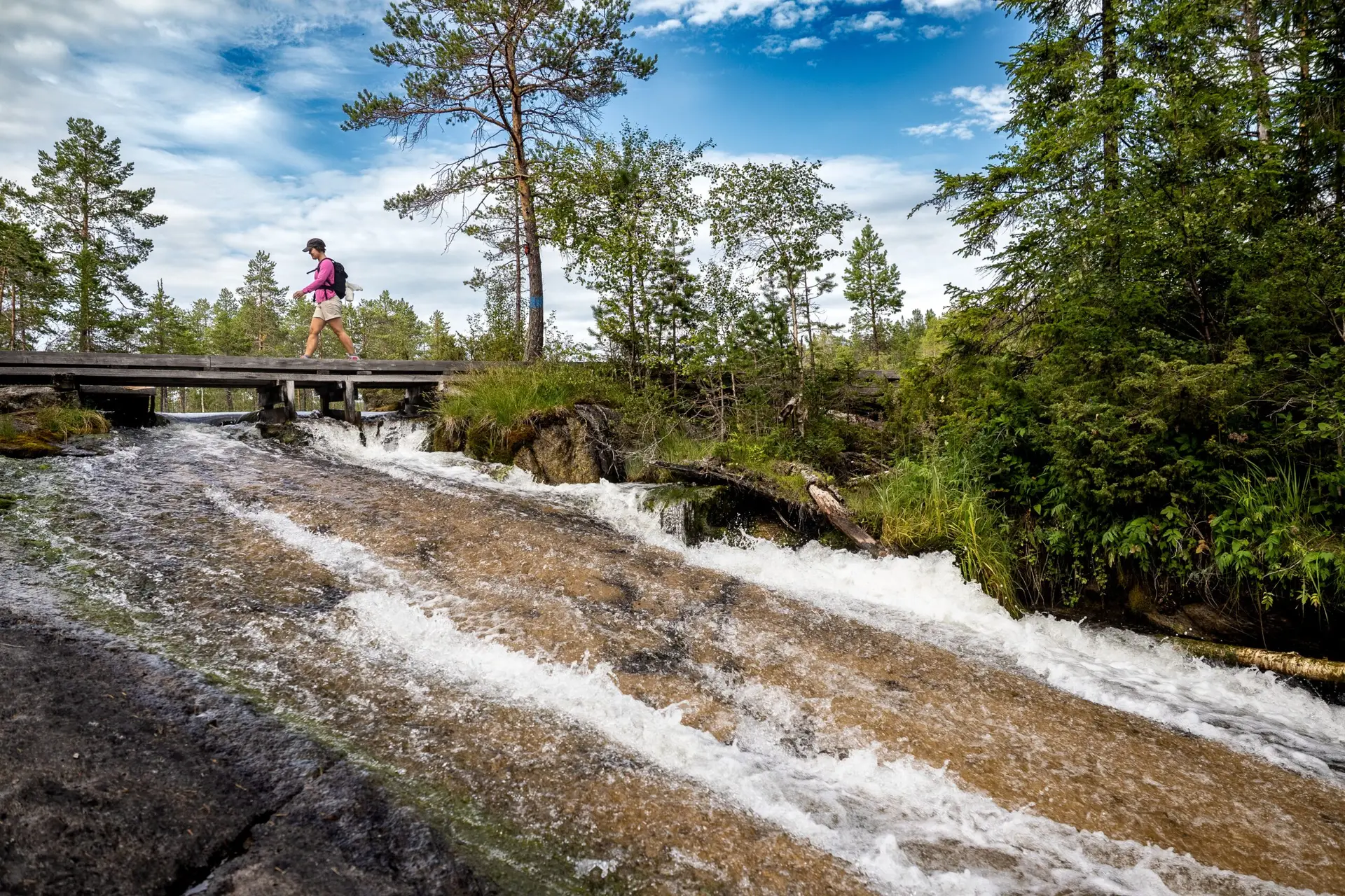
Forsaleden is a scenic trail that follows the Forsaån river along cliff faces, over bridges, and wooden walkways. Along the way, you’ll encounter waterfalls, streams, pools and ponds. There are many rare plant species due to the calcareous bedrock, and the water appears a beautiful greenish hue in several places thanks to high mineral content. The trail also features many lovely swimming spots and rest areas. There are cultural remains along the trail, including rock paintings from the stone age and an Iron Age grave.
Forsaleden has become a very popular destination and has needed improvements. The Bodsjö Local History Association took the initiative to improve the trail starting in the summer of 2024, in cooperation with Bräcke Municipality and SCA, the landowners. A lot of volunteer work has also contributed to raising the quality of the trail. The Pilgrim Trail Jämt-Norgevägen crosses Forsaleden. If you stop seeing the blue trail markers and start seeing pilgrim symbols instead, you’ve gone off track, which of course, I did. If there’s the slightest chance of going wrong, I’ll do it. My hikes often turn out longer than planned, but in such a beautiful natural area as Forsaleden, that doesn’t matter.
St. Olavsleden - pilgrim route
- Length: Total 580 km
- Start: Selånger
- Finish: Trondheim
St. Olavsleden is the northernmost pilgrim trail in the world. The trail is approximately 580 kilometers long and extends from the Baltic Sea in the East to the Atlantic Ocean in the West, from Selånger in Sweden to Trondheim in Norway. The trail goes through large forests, over mountains, along lakes and past communities and historic sites. The roadbed varies from gravel road, asphalt, and trails. St. Olavsleden is the Scandinavian equivalent to the El Camino de Santiago de Compostela, the famous pilgrim route to Spain.
The story of Olav Haraldsson – is based on fables and tales but also a few credible sources. Somewhere around the years 1230 – 1240, the Icelandic historian and author Snorri Sturluson wrote the Tales of the Nordic Kings, and one of the books is called “The tale of Olav the holy”, written 200 years after the death of Olav Haraldsson. The St. Olavsleden trail enters Jämtland Härjedalen in Gällö in Bräcke municipality and then continues to the border in Åre municipality. The pilgrim trails to Trondheim are expected to attract more hikers in the coming years leading up to 2030 when it will be 1,000 years since St. Olav died in the Battle of Stiklestad year 1030.
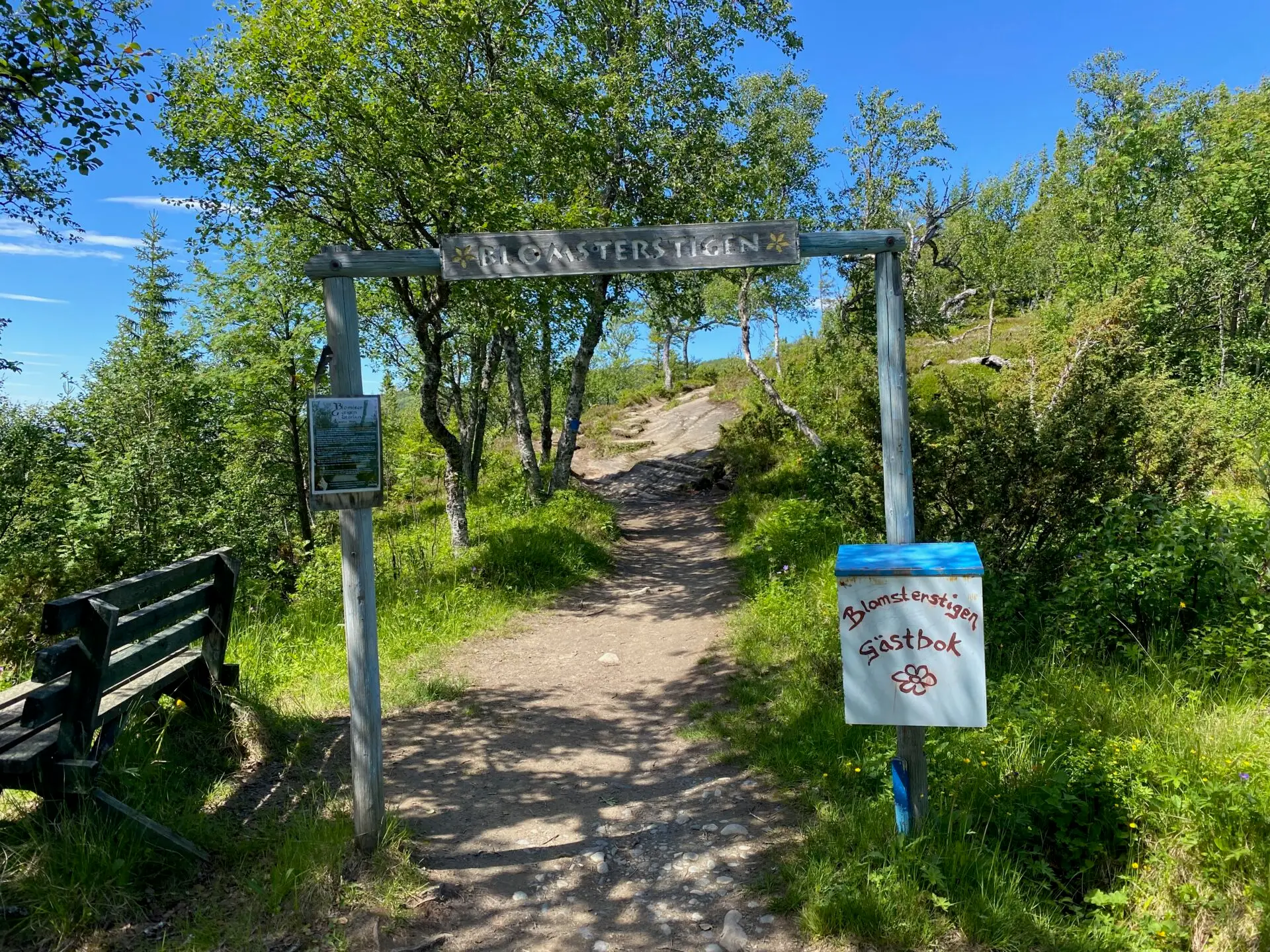
Åre municipality: Blomsterstigen in Storlien
- Length: 6 km roundtrip
- Elevation: 250 m
- Start: Storlien högfjällshotell
Blomsterstigen is probably the oldest hiking trail in the Swedish mountains, dating back to the late 1800s when it was first used for health and recreation. Dr. Westerlund, known as the “miracle doctor,” believed it was healthy to be above a certain altitude, to get exercise, feel meaningful and being social with other people, and Storlien could provide all that.
Dr. Westerlund’s patients came to Storlien to breathe the mountain air and walk on Blomsterstigen. In reality, the so- called “air guests” weren’t very sick; they were wealthy people from the cities who didn’t need to work for their food. Regardless, it marked the start of hiking tourism, for which we should be grateful today. With the introduction of the right of public access and statutory vacation (1938), it became possible for “ordinary” people from the cities to experience the Swedish mountains.
Blomsterstigen is an easy mountain hike around mount Skurdalshöjden with panoramic views in all directions from Vindarnas Tempel (Tempel of winds) at the summit. A final bonus tip is to make an additional hike to Brudslöjan (a waterfall on the Norwegian border).
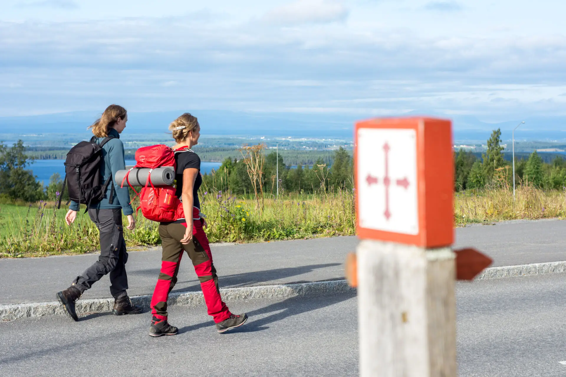
Jämt-Norgevägen: Pilgrim Route
- Length: 250 km (480 km)
- Elevation: 4 500 m
- Start: Jämtkrogen
The Fäbod Route: The trail then continues via Hackås Church, over to the Oviksbygden area and on towards Ljungdalen. This section is strongly characterized by a beautiful fäbod landscape.
The mountain world: From Ljungdalen, the hike continues up into the alpine mountain world. The trail passes the bare mountain between Helags and Fältjägarstugan, rounds Lake Sylsjön and connects to the Romboleden before finally crossing the Norwegian border on its way to Trondheim.
Åre: The western trail to the summit of Åreskutan
- Length: 7,6 km
- Elevation: 885 m
- Start: Åre square
The Western Trail (trail 214) to the summit of Åreskutan is a classic hike starting from Åre Square and leading to the peak. The trail is approximately 7.6 km long, rated as red, and is suitable for those seeking a longer, more demanding hike in Åre.
The route passes Fjällgården and continues along the historic Stjärnvägen trail. Higher up the mountain, the terrain becomes more technical, featuring boulders and rocky sections that require good balance, sure-footedness, and footwear with good grip.
This is a trail where you can start at various points and hike different sections, as well as use the lift or the Åre bergbana to cover parts of the route.
From Åre Square up to Fjällgården, you follow Trollstigen—a trail that is fun for children. You hike through the forest along the Mörviksån and Susabäcken streams, with little details to discover along the way. Look closely around you—you might just spot figures, mythical creatures, and other traces of the fairytale world of Trollstigen.