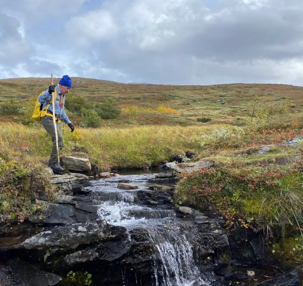
The favourite hikes of a true hiker – Jämtland Härjedalen Sweden

I was introduced early by my parents to be out in the mountains and nature, for which I am grateful. What I enjoy most is reaching the summits and enjoying the view – there’s something special about it. Hiking, for me, is a calming nature experience that recharges my batteries, and it’s a healthy way to get exercise. It’s always important to bring a good snack, especially if you have children. The snack is part of the hiking experience that should not be underestimated.

In this article you will be introduced to Andreas Edholm, senior tourism developer at Jämtland Härjedalen Tourism (JHT), and his all time favourite hikes in the region of Jämtland Härjedalen, or as we call it, Adventure Sweden.

Andreas father on a hike. Photo: Andreas Edholm
Andreas father on a hike by Storulvån, close to the Norwegian border. Photo: Andreas Edholm

How I selected my favourite hikes

“In my work establishing Jämtland Härjedalen Tourism (JHT) as the regional coordinator for hiking trails, we have identified and inventoried 285 miles of hiking trails in the region where the state is not the main responsible party. I have personally explored about 100 miles of these trails. It’s difficult to choose favorites since there are so many I would recommend, but here are 10 beautiful hiking trails, one in each municipality, plus two bonus routes.

I have also ensured that the trails I’ve chosen meet the basic quality criteria in the National Framework for Hiking Trails. Difficulty levels are subjective, but all of the trails I’ve selected are accessible to everyone, including families with children.”


Åre Municipality: Byxtjärn in Åre

Length: 4.5 km round trip
Elevation gain: 160 m
Start: Fröå Gruva
Map/trail description

Andreas daughter in Byxtjärn. Photo: Andreas Edholm
Andreas daughter at Byxtjärn in Åre Destination. Photo: Andreas Edholm

“The hike to Byxtjärn will always be special to me. It’s an easily accessible and beautiful trail through forest terrain, leading to a stunning view of Åreskutan at Byxtjärn. I’ve been to Byxtjärn more times than I can count. It was the first hiking trip I did with my wife when we first met, and it’s also the place where we had a naming ceremony for our daughter.

Byxtjärn is a shallow mountain lake and can get warm enough for even someone like me, who doesn’t usually swim, to dip my toes. Children, however, seem to swim no matter the temperature.The trail has become popular, but it is well maintained, and you can extend your hike by continuing up to the trail that circles Åreskutan, where you’ll essentially have the place to yourself. It’s also worth taking the time to visit Fröå Gruva and enjoy a good meal at Bergstugan.”


Östersund Municipality: Högforsleden in Lit

Length: About 7 km one way
Elevation gain: 310 m
Start: Lits Camping or Högfors Castle
Map/trail description

Högforsleden. Photo: Andreas Edholm
Högforsleden trail, not far from Östersund city. Photo: Andreas Edholm

“The hike between Lits Camping and Högfors Mansion takes you through varied nature and terrain. At a few points, the terrain gets a bit more hilly, and you can choose between two different routes, one easier and one steeper. The trail is well marked with orange signs. A local community group, in collaboration with landowners, has improved the trail in recent years. The most beautiful section is on the Högfors side along the ridge near Hårkan.

There are many attractions along the trail, including ancient hunting pits and the last ever used execution site of the region. Along the way, you can experience a rich wildlife and plant life, with information boards explaining various topics and history. Högfors Mansion is also worth visiting once you reach the Högfors side. The mansion is Sweden’s youngest manor house, built between 1954 and 1956 by the owner of Högfors Ironworks. In 1987, it was acquired by financier Maths O Sundqvist, but I have no idea who owns or lives in the mansion today.”


Härjedalen Municipality: Funäsdalsberget in Funäsdalen

Length: About 3 km round trip
Elevation gain: 350 m
Start: Gravel road or trails at the ski slope from the lift at Funäs Ski Lodge
Map/trail description

Funäsberget. Photo: Andreas Edholm.
Trail sign at Funäsberget, destination Funäsfjällen. Photo: Andreas Edholm.

If you want to hike up Funäsdalsberget in the middle of the village of Funäsdalen, you can either take the ski slope or the trail under the lift, which is a steep trail with climbing sections, so you then need to have via Ferrata equipment. Alternatively, you can take the gondola up if you just want to enjoy the view, have a snack at the restaurant, or visit the Sami park Lopme Laante, where you can also have a snack.

At the top of mount Funäsdalsberget, the view over the village Funäsdalen and surrounding mountains is incredible. If you want a local guide, contact Jon Wagenius from Strapatser. He’s an experienced and reliable guide, especially if you’re interested in the climbing trail. You’ll also get a lot of stories in the local dialect about all sorts of things. But don’t challenge Jon to run to the top; you don’t want to experience that humiliation…


Bergs Municipality: Fettjeåfallet in Klövsjö

Length: 3.5 km round trip
Elevation gain: 150 m
Start: Parking lot 5 km north of Klövsjö Ski Area
Map/trail description

Fettjeåfallet. Photo: Andreas Edholm.
The Sherpa stone trail to the waterfall Fettjeåfallet in Klövsjö, Destination Vemdalen. Photo: Andreas Edholm.

“During my years as CEO of Destination Vemdalen, we started to improve and market the hiking trails in the area. Locals said that Fettjeåfallet waterfall wasn’t worth mentioning, as it was just rocky and filled with roots. Today, the trail to Fettjeåfallet is the most visited in the Vemdalen area.The trail is quality-assured through collaboration between landowners and the destination organisation, which has helped fund stairs made of Offerådal slate, built by Nepalese Sherpas, rest areas, signs, and improvements to the trail.

You can continue above the rest area all the way to the waterfall itself, but be cautious not to trip on loose stones. There is also a “secret” trail up the side of the waterfall, but it’s only suitable for those with local knowledge and experience hiking in very steep terrain.


Strömsund Municipality: Klumplidklumpen in Jormvattnet

Length: 8.5 km round trip
Elevation gain: 410 m
Start: Korpens Öga in Jormvattnet
Map/trail description

Andreas colleague Mia hiking Klumplidklumpen. Photo: Andreas Edholm.
Andreas colleague Mia hiking with Andreas at Mount Klumplidklumpen. Photo: Andreas Edholm.

The trail starts on a forest road/snowmobile trail at Korpens Öga Mountain Riding, and after 1 km, you take a right turn at a marked crossing toward Klumplidklumpen. It’s 3 km through sparse mountain forest, marshes, and heathland. When you reach the top, the view is incredible on a clear day. On the highest rock slabs at the summit cairn, there’s a nice summit shelter/rest hut.

If you don’t want to retrace your steps, you can continue down to a mountain pasture called Mobergssätern, then onto a forest road from Blåsjöfallet toward Lilla Blåsjön. For someone like me with terrible sense of direction, it’s a good idea to check the map on your phone so you don’t miss the trail, as there are a few places where the trail markers where missing the last time I visited.

For anyone who has seen the film about the Swedish cartoon figure Dunderklumpen, Klumplidklumpen is the nose of the giant Jorm in the story. In Frostviken, you can experience pristine nature without crowds. The wilderness feeling here is probably unmatched by many other places in Jämtland Härjedalen. Vildmarksvägen (Wilderness Road) has become a concept and a reason to travel, and you can basically stop anywhere along the road and head straight into nature or the mountains. It’s unique and magnificent!


Ragunda Municipality: Stuguberget in Stugun

Length: 4.3 km round trip
Elevation gain: 150 m
Start: Hembygdsgården in Stugun
Map/trail description

Stuguberget. Photo: Andreas Edholm
Trail signage at Mount Stuguberget. Photo: Andreas Edholm

Within Ragunda Municipality, a recent collaborative project has improved the hiking trails. The goal has been to create clearly marked trails to protect nature while making it accessible to people. The signage has a unique character inspired by Czech markings, as one of the key figures in the project was from the Czech Republic. The Stuguberg trail is marked with red, making it easy to follow.

Hiking up Stuguberget is a nice walk with some steeper sections through the ski stadium, Jannebodarna, the telemast, and eventually up to Stuguberget before descending toward Åtegården (steeper section). There’s a nice rest shelter at the top, and the view of the Stugun village and surroundings is beautiful. Don’t get too close to the cliff, which is 80 meters high, and keep an eye on each other to ensure no one gets too close. Since the 1970s, Stuguberget has been one of Östersund Climbing Club’s most important climbing spots, with around 100 marked climbing routes for those with the necessary knowledge and equipment.

For those not satisfied after reaching Stuguberget, there are other easily accessible trails near the village. Trail maps and descriptions are available at Hembygdsgården – The homestead museum.

Bräcke Municipality: Forsaleden in Gällö

Length: 7 km one way
Elevation gain: 140 m
Start: Northern parking lot above/east of Långselet or southwest of Pilgrimstad, signposted from E14
Map/trail description

Forsaleden. Photo: Andreas Edholm
The Forsaleden trail goes past natural pools and streams. Photo: Andreas Edholm

Forsaleden is a scenic trail that follows the Forsaån river along cliff faces, over bridges, and wooden walkways. Along the way, you’ll encounter waterfalls, streams, pools and ponds. There are many rare plant species due to the calcareous bedrock, and the water appears a beautiful greenish hue in several places thanks to high mineral content. The trail also features many lovely swimming spots and rest areas. There are cultural remains along the trail, including rock paintings from the stone age and an Iron Age grave.

Forsaleden has become a very popular destination and has needed improvements. The Bodsjö Local History Association took the initiative to improve the trail starting in the summer of 2024, in cooperation with Bräcke Municipality and SCA, the landowners. A lot of volunteer work has also contributed to raising the quality of the trail.

The Pilgrim Trail Jämt-Norgevägen crosses Forsaleden. If you stop seeing the blue trail markers and start seeing pilgrim symbols instead, you’ve gone off track, which of course, I did. If there’s the slightest chance of going wrong, I’ll do it. My hikes often turn out longer than planned, but in such a beautiful natural area as Forsaleden, that doesn’t matter.


Krokom Municipality: Glösa and Bröllopsstenen in Alsen

Length: 4.6 km round trip
Elevation gain: 176 m
Start: Glösa rock carvings
Map/trail description

Glösa. Photo: Andreas Edholm.
Glösa rock carvings from the stone age depict 40 something moose and a net figure. Photo: Andreas Edholm.

When hiking up to Bröllopsstenen (The wedding rock) on the top of Mount Honingsberget, start by taking a moment at the stone age rock carvings at Glösa. The trail is part of the St. Olav’s Trail, and then you turn off from it, to the right, toward the mountain. After a while, you reach an old mountain pasture with an information sign telling the story of a woman who lived there.

By the way, I have a cousin who got engaged at Bröllopsstenen, but it didn’t last. Perhaps the couple after whom the stone was named had better luck. You can read more about them on the information sign at the top, which gives another reason to hike to Bröllopsstenen. The view from the top is incredibly beautiful, and there’s a viewfinder describing the surrounding mountains made by a colleague of mine at work. You can also enjoy a good lunch at Wången Inn, right by the large horse training center.


St. Olav’s Trail between Östersund and Rödöns Church

Length: 19.5 km
Start: Badhusparken in Östersund
Map/trail description

S:t Olavsleden Frösön. Foto: S:t Olavsleden
If you walk the whole S:t Olavsleden trail it will take you about a month. Photo: St Olavsleden.

We have five official pilgrim trails in Jämtland Härjedalen. Read more about them here. If I had to recommend one section of any of them, it would be the part between Östersund city and Rödöns Church on the St. Olav’s Trail. Since I live on Rödön, I’m a bit biased. However, I’ve explored the St. Olav’s Trail between Brunflo and the Norwegian border, and there are many other beautiful sections. When the weather is good, the view over the Storsjön lake and the Oviksfjällen mountains from Frösön island and the area Rödön, is fantastic.

The myth of pilgrimages has perhaps become that they want to find their inner self and discover the meaning of life, and often from a religious or spiritual perspective. As an atheist, I can’t really relate to that, but being in nature and the mountains gives me energy and peace of mind. Being present in the majestic nature and mountains is my “religion.”

The pilgrim trails to Trondheim are expected to attract more hikers in the coming years leading up to 2030 when it will be 1,000 years since St. Olav died in the Battle of Stiklestad year 1030.


Blomsterstigen in Storlien

Length: 6 km
Elevation gain: 250 m
Start: Storliens Högfjällshotell
Map/trail description

Blomsterstigen. Photo: Andreas Edholm.
Blomsterstigen, the floral path, leads from the border village Storlien and up on the nearby mountain top, past 30 something benches to rest on. Photo: Andreas Edholm.

“Blomsterstigen is probably the oldest hiking trail in the Swedish mountains, dating back to the late 1800s when it was first used for health and recreation. Dr. Westerlund, known as the “miracle doctor,” believed it was healthy to be above a certain altitude, to get exercise, feel meaningful and being social with other people, and Storlien could provide all that.

Dr. Westerlund’s patients came to Storlien to breathe the mountain air and walk on Blomsterstigen. In reality, the so-called “air guests” weren’t very sick; they were wealthy people from the cities who didn’t need to work for their food. Regardless, it marked the start of hiking tourism, for which we should be grateful today. With the introduction of the right of public access and statutory vacation (1938), it became possible for “ordinary” people from the cities to experience the Swedish mountains.

Blomsterstigen is an easy mountain hike around mount Skurdalshöjden with panoramic views in all directions from Vindarnas Tempel (Tempel of winds) at the summit. A final bonus tip is to make an additional hike to Brudslöjan (a waterfall on the Norwegian border) and or to visit Rypetoppen Adventure Park on the Norwegian side. It’s also a beautiful hike down towards the bottom of the waterfall and from there you can see the features of Rypetoppen with Via Ferratas, suspension bridges and tricky passages.

Skip to content